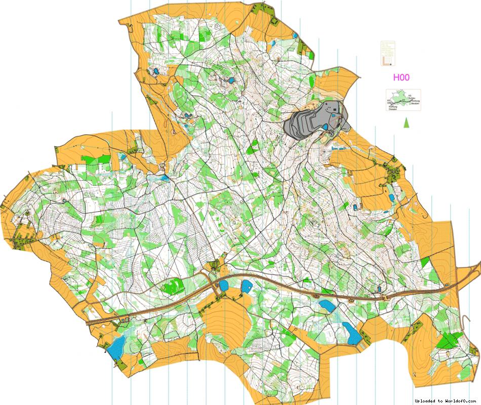
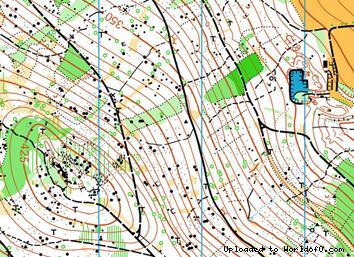
Orienteering Map Hochstein
19/11/2013: Due to changes with Google Maps currently no outline is shown for maps! Please let me know on jan@kocbach.net if this is an important functionality for you.
Rate this map!
Map name Hochstein Owner/Club Post SV Dresden Country Germany Year 2002 Scale 1:15000 Contours (meters) 5m Area (sqkm.) 16 km2 Nearest place or city Pulsnitz Region Sachsen Email address for ordering
no javascript, no e-mail! Owner webpage (url) Link Accessability (free access or need permission?) need permission Map type Regular map Map makers (fieldwork, drawing, etc.) Team Post SV Dresden Price per map (euro) 2 € Contact details for ordering/questions Andreas Lückmann
Dorfhainer Str. 11
D-01737 Kurort Hartha
+49 35203 32610 Terrain description Mischwald, 300 - 450m ü. NN, z.T. steiniger Untergrund und Felsen, dichtes Wegenetz
Comments about the map ISOM2000 OCAD-File, Karte ebenfalls in 1:10000 Source German map register(Source ID: GER-SX200201) Images (click for larger) Add/change info Click here
Access denied for user 'worldof_news'@'217.170.198.18' (using password: YES)