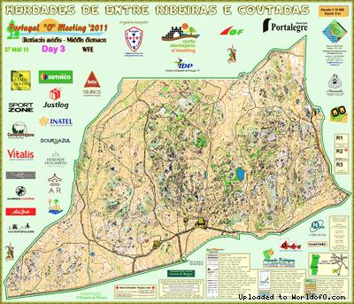
Orienteering Map Herdades de Entre Ribeiras e Coutadas19/11/2013: Due to changes with Google Maps currently no outline is shown for maps! Please let me know on jan@kocbach.net if this is an important functionality for you. Rate this map!
|
|
Orienteering Map Herdades de Entre Ribeiras e Coutadas19/11/2013: Due to changes with Google Maps currently no outline is shown for maps! Please let me know on jan@kocbach.net if this is an important functionality for you. Rate this map!
|
|