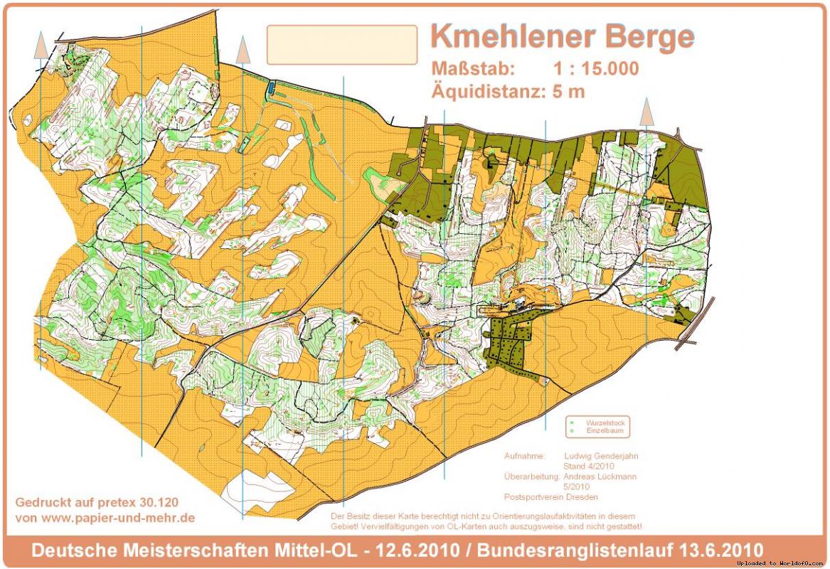
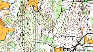
Orienteering Map Kmehlen
19/11/2013: Due to changes with Google Maps currently no outline is shown for maps! Please let me know on jan@kocbach.net if this is an important functionality for you.
Rate this map!
Map name Kmehlen Owner/Club Post SV Dresden Country Germany Year 2010 Scale 1:10000 Contours (meters) 5m Area (sqkm.) 4 km² km2 Nearest place or city Ortrand Region Brandenburg und Sachsen Email address for ordering
no javascript, no e-mail! Owner webpage (url) Link Accessability (free access or need permission?) nach Absprache Map type Regular map Map makers (fieldwork, drawing, etc.) Ludwig Genderjahn und Andreas Lückmann Price per map (euro) 3 € Contact details for ordering/questions Andreas Lückmann
Dorfhainer Straße 11
D-01723 Kurort Hartha
0049-35203-32610 Terrain description Mischwald, wechselnde Belaufbarkeit, feinkuppiert, z.T. steile Hänge bis zu 50Hm, dichtes Wegenetz Source German map register(Source ID: GER-SX201002) Images (click for larger) Add/change info Click here
Access denied for user 'worldof_news'@'217.170.198.18' (using password: YES)