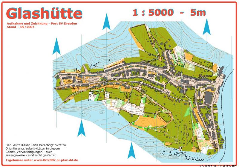
Orienteering Map Glashütte
19/11/2013: Due to changes with Google Maps currently no outline is shown for maps! Please let me know on jan@kocbach.net if this is an important functionality for you.
Rate this map!
Map name Glashütte Owner/Club Post SV Dresden Country Germany Year 2007 Scale 1:5000 Contours (meters) 5 Area (sqkm.) 0.5 km2 Nearest place or city Glashütte Region Sachsen Email address for ordering
no javascript, no e-mail! Owner webpage (url) Link Accessability (free access or need permission?) free access Map type Sprint map Map makers (fieldwork, drawing, etc.) Team Post SV Dresden Price per map (euro) 2 € Terrain description Innenstadt und Stadtrand mit Wald und Wiesen, 320 - 420 m ü. NN, steil
Comments about the map ISSOM 2007 Ocad-file Source German map register(Source ID: GER-SX200701) Images (click for larger) Add/change info Click here
Access denied for user 'worldof_news'@'217.170.198.18' (using password: YES)